MK Smart Cycling Project
The MK Smart Cycling Project is here to make cycling safer, smarter, and more enjoyable. This innovative initiative invites local residents to use a powerful, app-enabled front/rear bike light that not only improves visibility but also provides valuable data insights into cycling journeys across Milton Keynes. These insights help inform Transport Planners to develop a better, more connected cycling network.
Last year, 100 volunteers helped us collect valuable data using smart cycling sensors. This year, we have a limited number of spare sensors available for new volunteers. We have extended the project for another year and are looking for residents who cycle regularly in Milton Keynes to join us.
What Will You Receive?
 You will receive an ICON3 Smart Bike Light, provided in partnership with See.Sense.
Smart Features
This smart light is designed to be highly visible even in daylight and reacts to your environment by flashing brighter and faster in riskier situations, such as braking at junctions or roundabouts, helping to keep you safer on the roads and Redways.
- App Connectivity: Links to a free smartphone app with features like theft alerts and crash notifications (including GPS location sharing with a nominated contact).
- Safety Reporting: Drop a pin on the map to report issues such as close passes or request new bike lanes.
- Data Insights: Collects anonymised sensor data on speed, delays, collisions, heavy braking, swerving, dwell times, and surface conditions to help city planners improve cycling infrastructure.
All of the journey data shared with Milton Keynes City Council is anonymised and aggregated.
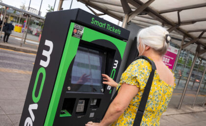
How to Get Involved?
If you’re interested, please complete our Expression of Interest form. Applications will remain open until 31st May.
To better understand how our cycling network is used by different groups, we aim to include participants of varying ages, focusing on people who cycles frequently, while maintaining a 50:50 gender split.
Why do we need data?
Most trips are relatively short. According to the National Travel Survey 2021, 25% of trips were under 1 mile, and 72% under 5 miles. These proportions of short trips are broadly consistent to how they were in 2020 and in 2019, with 25% of trips being under 1 mile and 71% of trips being under 5 miles in 2020 and 24% of trips being under 1 mile, and 68% under 5 miles in 2019.
In order to reduce emissions and improve people’s general health and wellbeing it is vital that we see a drastic increase in the number of people walking and cycling for everyday purposes. However, without an adequate walking and cycling network that provides a real alternative to cars, this reliance on vehicles for short journeys will remain.
Effective cycle infrastructure planning is vital to increasing active travel uptake and ensuring that we achieve the modal shift towards cycling that is necessary if we are to achieve our climate targets. Without quality cycling networks that are coherent, direct, safe, comfortable and attractive, we simply won’t see a large enough increase in cycling.
See.Sense Bike Light Solutions
In order to plan and build effective cycling infrastructure, high-quality, insightful data is needed. While methodology and approaches to cycle network planning vary across countries, the need for data remains consistent.
See.sense lights contain sensor technology that monitors the environment over 800 times a second, allowing See.Sense to provide highly granular anonymised insights into the rider’s experience, including breaking, swerving, collisions and road surface conditions, while the dashboard can also show route popularity, average speeds and dwell times. As a result, See.Sense can provide valuable, targeted insights that act as key evidence for cycle infrastructure planning.
See.Sense lights can provide data on current cycling transport networks, as the data collected provides insights into route popularity and movement patterns. This means we are able to identify information such as transport patterns, travel patterns, and the location of significant trip generators. Crucially, unlike most existing data sets, the data insights provided via the See.sense lights are relevant and up to date, as this data is collected continually through the lights.
Additionally, the data insights can ensure a proposed cycle route conforms to the five key design principles identified by the Dutch CROW Bike Design Manual. That is, that a route is coherent, direct, safe, comfortable, and attractive. By examining route popularity, we can view how coherent and direct a cycle route is. We can determine if people are diverging from a particular route, and if a proposed route adequately connects popular origin and destination points. Through dwell time data, it is also possible to view junctions that cause delays – another determining factor into how coherent a route is.
See.Sense lights measure incidents of swerving and heavy braking, allowing us to also determine the safety of a proposed cycle route. In previous studies, heavy breaking data has been consistently shown to correlate with locations of officially recorded collisions. By identifying hotspots of swerving and heavy braking, the data is able to earmark specific unsafe locations. Additionally, we can assess and map road surface quality. This not only aids a route’s safety, but also a route’s comfort, as rough areas that may deter cyclists can be flagged for maintenance.
Where See.Sense Data Adds Insight

For more information on See.sense, go to See.Sense – Cycling Technology and Data for Better Rides (seesense.cc)